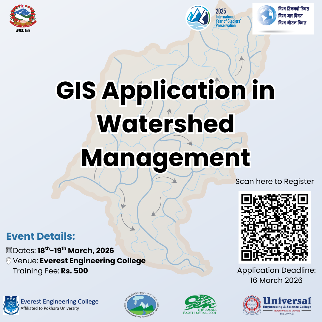
As a part of Nepal National Glacier, Water and Weather Week (NNGWWW) 2026, The Small Earth Nepal (SEN), Society of Hydrologists and Meteorologists (SOHAM), Everest Engineering college, and Universal Engineering and Science College, are jointly organizing a training program focused on Geographic Information System (GIS) for watershed management. This comprehensive training aims to build knowledge and practical skills on how geospatial tools can be used to better understand watersheds, assess environmental risks, and support sustainable water resource management and disaster risk reduction.
Watershed management is an important process to protect, manage, and use water resources wisely, maintain ecological balance, and support the livelihoods of people who depend on land and water. In Nepal, this is especially important because the country is largely made up of steep mountains, water sources, and river systems. These landscapes are often affected by problems such as soil erosion, landslides, floods, ecological imbalance, and uneven water availability. Managing watersheds in scientifically backed studies helps reduce these risks and supports sustainable use of natural resources.
In this context, the Geographic Information System (GIS) has emerged as an invaluable tool which enables us to collect, store, analyze, and visualize geographic or spatial data through maps and digital tools. It allows us to map and plan watershed properties such as drainage patterns, flow characteristics and manage water-induced disasters, such as identifying vulnerable and susceptible locations and potential hazards (landslide, flood, GLOF, and LDOF) and observe environmental changes over time. By combining different types of information such as remote sensing earth observation, climate information, geological and geographical properties, and watershed properties, GIS helps researchers, scientists, policymakers, planners, and developers to better understand how watersheds function, manage watersheds, wisely use support, and make decisions.
This hands-on training will give participants the opportunity to learn how GIS and spatial analysis can support scientifically informed watershed planning and decision-making, contributing to a more resilient and sustainable future for Nepal’s water systems. This collaborative effort also aims to create a platform for learning, knowledge sharing, and capacity building, encouraging participants to explore innovative uses of geospatial tools for environmental and watershed management.
Date
18 and 19 March 2026
Location
Everest Engineering College, Sanepa, LalitpurMode of Training
In-person
Resource person
Assoc. Prof. Raghu Nath Prajapati, PhD
Nepal Engineering College
Kuala Lumpur University of Science and Technology (KLUST)
Application Deadline
16 March 2026